
Quick answer: Rural subdivision in Auckland is possible on many lifestyle blocks, but even a fully compliant Countryside Living subdivision is a discretionary resource consent, most areas need every lot to be at least 2 hectares, and splitting off a minor dwelling below the zone minimum is prohibited.
You own a few hectares out past Kumeu or up near Warkworth, the kids want to build nearby, and someone at a barbecue told you the block “can definitely be cut in two”. Maybe it can.
The answer sits in a rulebook most owners never open, and it is far more particular than a single minimum lot size. Which part of rural Auckland you are in changes the numbers. Whether your land is an approved receiver site changes them again. And each new lot has to prove it can hold a house, a driveway, a septic field and a water supply before the council will look at the boundary lines.
That rulebook is the Auckland Unitary Plan, the single planning document for the whole region. Its rural subdivision chapter is short enough to read in an evening, and most of the answers to “can we split it?” are sitting in four of its tables.
Rural subdivision in Auckland starts with your zone
Every property in Auckland sits in a zone under the Auckland Unitary Plan, and the zone decides which set of subdivision rules applies. Residential, business and most other zones fall under chapter E38, the urban subdivision rules. Rural land falls under chapter E39, “Subdivision – Rural”, and it is a different world. If your title sits in a rural zone, most of what you have read about subdividing a suburban section does not apply to you. Our guide to how subdivision works in Auckland’s residential zones covers the urban side; this one covers the rural side.
The zones E39 covers
According to chapter E39 of the Auckland Unitary Plan (July 2026 version), the rural subdivision rules apply to the Rural Production, Mixed Rural, Rural Coastal, Rural Conservation and Countryside Living zones, the two Waitākere Ranges zones, the Future Urban Zone and the Quarry zone. You can check your zone on Auckland Council’s online planning maps, and it is printed on a LIM (Land Information Memorandum, the council’s report on a property).
Of those, the Countryside Living Zone is the one built for lifestyle subdivision. The Plan’s own description, in chapter H19, says the zone “provides for rural lifestyle living in identified areas of rural land which are generally closer to urban Auckland or rural and coastal towns”, and that it is the receiving area for transferable rural site subdivision (more on that below). The working farmland zones are deliberately harder to break up.
What the consent category tells you
Subdivision in any rural zone needs a resource consent, which is the council’s permission to use or divide land in a particular way. It is separate from a building consent, which covers the construction work itself. The Plan sorts every activity into a category, and the category tells you how much discretion the council has.
| Subdivision in E39 | Category | What it means in plain English |
|---|---|---|
| Countryside Living Zone, meeting the site-size standard (rule A14) | Discretionary | The council can grant or decline it and can attach conditions |
| Countryside Living Zone, not meeting the standard (A15) | Non-complying | A tougher legal test applies before the council can grant it |
| Production, Mixed Rural, Coastal or Conservation zones, meeting the standard (A12) | Discretionary | As above, with far larger minimum sizes |
| Transferable rural site subdivision meeting its standards (A20, A22, A24) | Restricted discretionary | The council can only weigh the matters the Plan lists |
| Splitting a minor dwelling from the main house below the zone minimum (A26) | Prohibited | No resource consent can be applied for |
Look at that first row. Meeting the minimum lot size does not make a Countryside Living subdivision a box-ticking exercise. It makes it eligible to be considered. The council still assesses the design, and the Plan says discretionary applications go through the normal notification tests, so neighbours may be asked for their written approval or notified, depending on the effects.
Minimums in the farming zones
Outside Countryside Living, the numbers are set to protect working land. E39’s standard for the Rural Production, Mixed Rural, Rural Coastal and Rural Conservation zones sets these minimums:
| Zone | Minimum average site size | Minimum site size |
|---|---|---|
| Rural Production | 100 ha | 80 ha |
| Mixed Rural | 50 ha | 40 ha |
| Rural Coastal | 50 ha | 40 ha |
| Rural Conservation | 20 ha | 10 ha |
So a 12-hectare block zoned Mixed Rural cannot be split as of course; it is nowhere near 40 hectares a lot. For most owners asking “can I subdivide my rural property?”, the honest first answer is: only if the land is zoned Countryside Living, or if one of the special routes in E39 fits.
💡 Homeowner tip: Check the zone on the title before you pay anyone to draw lines on it. A block that looks like every other lifestyle property on the road can be zoned Mixed Rural, and that single fact ends the conversation.
Countryside Living minimum lot sizes, area by area
If your land is zoned Countryside Living, the next question is where it sits. E39 does not give one number for the whole zone. Its Table E39.6.5.2.1 lists named areas, each with its own minimum net site area and minimum average, and a second column for lots created through transferable rural site subdivision.
The table itself
| Countryside Living area | Without a transferable site | With a transferable site |
|---|---|---|
| Areas not named below | Minimum 2 ha | Not available |
| Wellsford, Kaukapakapa, Helensville | Minimum 2 ha | Minimum 8,000 m², average 1 ha |
| Warkworth | Minimum 2 ha | Minimum 8,000 m², average 1 ha |
| Matakana, Kumeu-Huapai, Paremoremo-Albany Heights | Minimum 2 ha | Minimum 8,000 m², average 1 ha |
| Algies Bay | Minimum 2 ha | Minimum 8,000 m², average 1 ha |
| Puhoi, Parakai | Minimum 2 ha | Minimum 8,000 m², average 1 ha |
| Waimauku | Minimum 2 ha | Minimum 8,000 m², average 1 ha |
| South Rodney | Minimum 2 ha | Minimum 8,000 m², average 1 ha |
| Whitford (excluding the precinct and Caldwells Road) | Minimum 2 ha, average 4 ha | Not available |
| Whitford, Caldwells Road | Minimum 1 ha, average 2 ha | Not available |
| Papakura | Minimum 1 ha | Not available |
| Point Wells | Minimum 5,000 m², average 7,500 m² | Not available |
| Runciman | Minimum 2 ha | Minimum 8,000 m², average 1 ha |
| Swanson (outside the precinct) | Minimum 4 ha | Not available |
| Okura East | Minimum 4 ha | Not available |
Source: Auckland Unitary Plan, E39 Subdivision – Rural, Table E39.6.5.2.1 (July 2026 version). Where the Plan uses “minimum net site area and average net site area”, the table above shows the minimum and, where the Plan sets one separately, the average.
Net site area is smaller than your title
The table talks about net site area, and that is not the figure on your title. The Plan’s definitions chapter, Chapter J, defines net site area as the total area of a site excluding any area under a road-widening designation, any part of an entrance strip, any legal right of way and any access site. So the long driveway leg that reaches a rear lot does not count towards that lot’s size.
That matters on the margin. Imagine a 4.1-hectare block in Waimauku, zoned Countryside Living. On paper, two lots of just over 2 hectares each looks like it works. But if the rear lot needs a 300-metre access leg, the leg comes off its net area, and the scheme can drop below 2 hectares a lot. Net area, not the gross figure on the title, is where a scheme that looks fine on paper falls short.
Averages, frontage and no banked credits
Where an area has a minimum average as well as a minimum, the average is worked out across every site in that subdivision scheme plan. E39 is explicit that “no credits will be carried forward to future subdivision scheme plans”. You cannot create one oversized lot now and draw on its surplus in a later round.
The same standard sets frontage, meaning the length of boundary a site has along the road: at least 15 metres for every front site and 6 metres for every rear site. On a narrow road frontage with two or three lots behind it, those numbers decide the layout before anything else does.
💡 Homeowner tip: Ask for the net area of each proposed lot, not just the gross total, at your first meeting with a surveyor or designer. If the access leg pushes a lot under the minimum, the scheme moves from discretionary to non-complying.
Transferable rural sites: the route to a smaller lot
The right-hand column of that table only opens up through a mechanism called transferable rural site subdivision. The idea is a trade. A landowner earns the right to create an extra lifestyle site by doing something the Plan wants elsewhere, such as protecting native bush or combining small parcels of good farmland. That right is then used on a “receiver” site in the Countryside Living Zone, where lots can be smaller than usual.
Donor sites and receiver sites
E39 calls the land that gives up the development right the donor site, and the land where the new lot is created the receiver site. The rules are blunt about the split: a donor site “must not be the same site as a receiver site”. The receiver has to be in the Countryside Living Zone and be identified as an eligible receiver site by the Subdivision Variation Control on the planning maps. Then the lots have to meet the transferable-site column of the table, which in the named northern and western areas is a minimum of 8,000 m² with an average of 1 hectare.
So owning a Countryside Living block in Kumeu-Huapai does not by itself get you 8,000 m² lots. You need a transferable site to bring to it, and your land has to be on the map as a receiver.
Three ways a site is created
The Plan provides three sources for a transferable site:
- Protecting indigenous vegetation or a wetland in the Significant Ecological Areas Overlay (an overlay mapping native bush, wetlands and habitats the Plan treats as significant), or vegetation that meets the same ecological factors.
- Establishing revegetation planting to the Plan’s standards.
- Amalgamating donor sites, meaning merging two small titles into one.
For the first two, E39 requires a protective covenant (a legal restriction recorded on the title) to be registered against the title holding the bush or wetland, and the subdivision consent has to carry a condition that the plan creating the receiver lots is deposited “after, and not before” that covenant is registered. The order matters for anyone planning finance or a sale around the new lot.
Amalgamating farmland titles
The amalgamation route has its own tests. Under E39.6.4.7, the donor sites must adjoin each other, must be zoned Rural Production, Mixed Rural, Rural Coastal or Rural Conservation, must each be between 1 and 20 hectares net, and the land must contain at least 90 per cent elite or prime soil, confirmed by a Land Use Capability soil assessment (a standard rating of how productive land is) from a suitably qualified person. After amalgamation, the merged land goes onto a single title with a legal protection mechanism stopping further residential development and further transfers.
How many new sites that earns depends on location. Table E39.6.4.7.1 allows two new sites for every two donor sites amalgamated inside the Plan’s Land Amalgamation Incentivised Area (Appendix 14), and one new site for every two donor sites outside it.
Why the category matters
A transferable rural site subdivision that meets its standards is restricted discretionary, while an ordinary Countryside Living subdivision is fully discretionary. Restricted discretionary means the council can only weigh the matters the Plan lists for that activity. It is not an easier site to find, but it is a narrower assessment once you have one. Imagine two owners on the same road near Matakana: one splits 6 hectares into three 2-hectare lots the ordinary way, the other brings a transferable site and creates a smaller lot. The second owner faces more legal steps before lodging, and a more contained assessment after it.
💡 Homeowner tip: Before you buy or sell a “transferable title”, confirm two things in writing: that the receiver land is shown as eligible on the Subdivision Variation Control map, and that the donor side meets every E39 standard. One without the other is not a lot.
Will each new lot be buildable? The design inside a subdivision
This is where rural subdivision stops being a planning exercise and becomes a design one. Before the council grants a rural subdivision, each new site has to show where a house can actually go, how a vehicle gets to it, and how it will be serviced. We lay out building areas and lot boundaries on rural and lifestyle subdivisions for exactly this reason: the boundary lines follow the buildable land, not the other way round.
The 2,000 m² specified building area
E39’s general standards require a specified building area to be clearly identified on every site on the scheme plan where a building is to be built. If there is already a house, the building area has to include it, or show it being removed or relocated. The standard then sets the test that does the real work: each specified building area must include a single area of at least 2,000 m² clear of all yards, flood plains, coastal inundation and erosion areas, unstable land, the access to the building platforms and the on-site private infrastructure.
The septic field is the item that catches people out. On a rural lot without a public sewer, the wastewater disposal area is on-site infrastructure, so it sits outside the clear 2,000 m². The building area must also link to a formed public road by adequate vehicle access, sit outside the Quarry Buffer Area Overlay, and be “the only place within the site where dwellings, any accessory buildings, and related parking and manoeuvring areas can be located”. Once the subdivision is approved, that box on the plan is where the house goes.
Yards in the rural zones
Yards are the setbacks a building must keep from each boundary. Chapter H19, Rural zones, sets them in Table H19.10.3.1: a 10-metre front yard (20 metres on an arterial road shown on the planning maps), a 12-metre side and rear yard for dwellings and their accessory buildings, 20 metres within a Quarry Buffer Area Overlay, a 20-metre riparian yard (the strip beside a waterway) from the edge of permanent and intermittent streams, and a 30-metre lake yard. H19 also caps dwellings and their accessory buildings at 9 metres high.
On a 2-hectare lot those yards rarely bite. On a narrow lot, or one with a stream running through it, they can swallow most of the land. A stream along one boundary takes a 20-metre strip; add a 12-metre side yard and a steep gully, and the clear 2,000 m² may only exist in one corner.
Access, water and fire
Every new site needs legal and physical access to a road, unless it is being created for a reserve, a network utility or a road closure, or will be merged with land that already has access. The services standard requires each building to be designed and located so that provision is made for stormwater, wastewater, water supply, electricity and telecommunications.
Most lifestyle blocks are not on a public water main, and E39 has a specific rule for that: where no reticulated supply is available, the subdivision must provide sufficient water supply, and access to it, for firefighting in line with the firefighting water supplies code of practice, SNZ PAS 4509:2008. That supply takes up room on the lot and needs access, so it belongs on the concept plan from day one.
Hazards, overland flow and bush
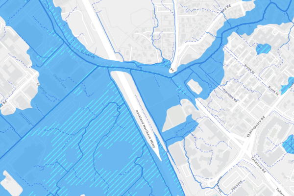
E39 also requires every subdivision to be designed around the overland flow paths already on the site (the routes rainwater takes across the ground when the drains are full), and stormwater must leave the site somewhere that does not raise the hazard for properties downstream. Our post on what flood plains and overland flow paths do to where you can build goes through how those layers are mapped.
Subdividing land inside a 1 per cent annual exceedance probability floodplain (an area with a 1-in-100 chance of flooding in any year), a coastal inundation or erosion area, or land subject to instability is itself a restricted discretionary activity. The July 2026 text of E39 marks several of these hazard clauses as affected by Plan Change 120, Auckland Council’s proposed replacement housing rules, with “immediate legal effect”, so they already apply while the plan change runs.
Finally, every subdivision plan other than a boundary adjustment must show any Significant Ecological Area, native vegetation, wetland, stream, river or lake on or along the boundary of the land. On bush-clad blocks in the Waitākere foothills or around Puhoi, that mapping often decides where the building area can go at all.
Important: Rural subdivision needs a resource consent from Auckland Council, and the house on each new lot will need its own building consent or a confirmed exemption. Plan Change 120 and the zone rules can change what applies to your site. Confirm your zone, overlays and the current rules with Auckland Council or a planner before you commit to a scheme, and use a Licensed Building Practitioner for any restricted building work.
💡 Homeowner tip: Sketch the septic field, the water tank, the driveway and every yard on an aerial photo before you sketch the house. If you cannot find 2,000 m² clear of all of them on each lot, a surveyor’s scheme plan will not find it either.
A second home instead of a second title
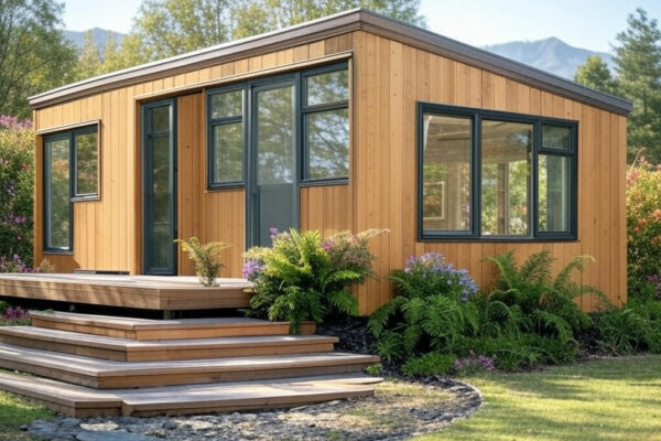
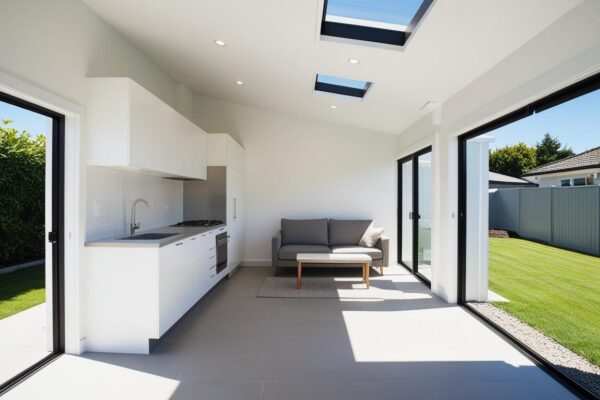
A lot of rural subdivision enquiries are really housing enquiries. The goal is a home for parents or adult children on the same land, and a separate title is assumed to be the way to get there. On a block that cannot meet the minimum lot size, a minor dwelling (a small second home on the same site) may get you the house without the subdivision. What it will not get you is the title.
The Unitary Plan’s minor-dwelling rules
In the rural zones, H19 makes a minor dwelling a restricted discretionary activity, so it needs a resource consent, and sets four conditions in standard H19.10.11: no more than one minor dwelling per site, the site must be larger than 1 hectare, the minor dwelling must have a floor area under 65 m² excluding decks and garaging, and it must share the same driveway access as the main house. It must also meet the zone’s yards and height limits. Miss one of those and the minor dwelling becomes non-complying.
The national standard for detached units
Since 15 January 2026 there has been a second route. The Resource Management (National Environmental Standards for Detached Minor Residential Units) Regulations 2025 make one detached minor residential unit per site a permitted activity, meaning no resource consent, in residential, rural, mixed use and Māori purpose zones, if it meets the regulations’ standards. For a rural zone those are: a floor area of 70 m² or less, measured between the finished inside faces of the external walls; building coverage that complies with the district plan; at least 2 metres from the main house; and at least 10 metres from the front boundary and 5 metres from the side and rear boundaries. Since an amendment on 11 September 2026, the boundary setbacks are measured to the exterior face of the unit’s wall.
Two parts of the regulations matter most on a lifestyle block. Regulation 7(4) says no other district plan rules apply to a compliant unit beyond the ones the regulations keep, which include rules on subdivision, historic heritage and other matters of national importance, earthworks, natural hazards and site infrastructure. And regulation 3(4) says that where a council has not yet adopted the national zone names, its nearest equivalent zones are used. The Unitary Plan’s zone names differ from the national ones, so ask Auckland Council how it reads your zone before relying on the permitted route.
The rule that stops the split
Whichever route the second home takes, the title question is settled in the Unitary Plan. E39 rule A26 makes the subdivision of a minor dwelling from the principal dwelling, where the proposed sites do not meet the zone’s minimum site size, a prohibited activity. H19 says the same for the rural zones in rule A68. Prohibited means no resource consent can be applied for at all. And the national standard does not change that, because regulation 7(2)(a) keeps the district plan’s subdivision rules in force for these units.
So if your plan is “build the granny flat now and subdivide it off later”, test it against the minimum lot size today. If the land could not be subdivided without the second home, the second home does not change the answer. The building consent side is a separate question again, and our feasibility work checks what a block can take before any design fees are spent, so both questions get tested together.
💡 Homeowner tip: Decide what you actually need: a separate home or a separate title. A home for family can often be done on one title. A lot you can sell or mortgage separately needs the full subdivision tests, and a second home on the land does not count towards them.
Testing a block in the right order
A rural subdivision draws on several professionals, and the order you bring them in changes what it costs you to find out the answer. A licensed cadastral surveyor prepares the scheme plan (the drawing of the proposed lots and boundaries) and, later, the survey plan the titles come from. A planner prepares the assessment for the resource consent. Engineers report on access, stormwater, wastewater and ground stability where the site needs it. A designer works out where each house, driveway and set of services can physically go, which is the specified building area test in practice.
Start with a desktop check. Zone, overlays, the Countryside Living area and whether the land is a mapped receiver site can all be read from the planning maps and the LIM before anyone visits. That step alone sorts most enquiries: a block that is Mixed Rural, or a Countryside Living block in Swanson that is under 8 hectares, cannot be split into two complying lots.
If the numbers can work, the next step is to test whether each lot can hold its 2,000 m² clear area once yards, streams, slopes, floodplain, septic field and access are drawn in. This is design work done on contours and aerial photos, and it is cheaper than a full scheme plan. It also tells you whether the lot boundaries need to bend around the land, which they usually do.
Then comes the money question. Sonder is a design practice, so we do not publish subdivision cost figures. Superior Homes, our sister company that handles subdivision economics, sets out the costs involved in subdividing land in Auckland. Council fees and deposits change every 1 July, so read them off Auckland Council’s current schedule rather than any summary.
💡 Homeowner tip: Bring the LIM, the title and any old scheme plans to your first meeting. Easements, covenants and consent notices on rural titles can rule out a building area before the zone rules even come into it.
Before you call the surveyor
The cheapest moment to learn that a block will not split is before anyone has been paid to draw it. Zone, area, net site area and one clear 2,000 m² patch per lot: if any of those four fails, the scheme plan cannot rescue it, and a second home on one title may be the better use of the land. If all four hold, you have a subdivision worth designing properly.
➡ Book a free consultation with Sonder Architecture
➡ Request your free feasibility report
➡ See how we plan subdivisions and multi-lot sites
➡ See recent projects we’ve done across Auckland
Can I subdivide my rural property in Auckland?
Only if the zone and the numbers allow it. Lifestyle subdivision is mainly provided for in the Countryside Living Zone, where most areas need each lot to be at least 2 hectares net. The farming zones have minimums of 10 to 80 hectares a lot. Even a compliant Countryside Living subdivision is a discretionary resource consent, so the council can still decline it or attach conditions.
What is the minimum lot size in the Countryside Living Zone?
It depends on the area. Table E39.6.5.2.1 of the Unitary Plan sets 2 hectares for areas it does not name, 2 hectares with a 4-hectare average in most of Whitford, 1 hectare in Papakura, 5,000 m² with a 7,500 m² average in Point Wells, and 4 hectares in Swanson outside the precinct and Okura East. Lots are measured by net site area, which excludes access legs and rights of way.
What is transferable rural site subdivision?
It is a trade. A landowner earns the right to an extra lifestyle site by protecting native bush or a wetland, establishing revegetation planting, or amalgamating small titles of good farmland. That right is used on a mapped receiver site in the Countryside Living Zone, where lots can go down to 8,000 m² with a 1-hectare average in the named northern and western areas.
Can I subdivide off a granny flat on my lifestyle block?
Not if the new lots would be below the zone minimum. Unitary Plan rule E39 A26, and rule A68 in the rural zones chapter, make subdividing a minor dwelling from the main house in that situation a prohibited activity, so no consent can be applied for. The national standard for detached minor units keeps district plan subdivision rules in force, so it does not change this.
Can I build a minor dwelling on a rural property instead?
Often, yes. The Unitary Plan allows one minor dwelling per site in the rural zones as a restricted discretionary activity, on a site over 1 hectare, under 65 m² excluding decks and garaging, sharing the main driveway. The national standard for detached minor residential units also permits one detached unit up to 70 m², set back 10 metres from the front boundary and 5 metres from the sides and rear.
What is a specified building area?
It is the area on each new rural lot where the house, accessory buildings, parking and turning must go. Unitary Plan standard E39.6.1.1 requires it to include a single area of at least 2,000 m² clear of yards, floodplains, coastal hazard areas, unstable land, access and on-site services such as a septic field, and to link to a formed public road.
How far must a house be from the boundary on a rural lot?
Chapter H19 of the Unitary Plan sets a 10-metre front yard, or 20 metres on an arterial road shown on the planning maps, and a 12-metre side and rear yard for dwellings in the rural zones. Buildings must also stay 20 metres from the edge of permanent and intermittent streams and 30 metres from lakes. Dwellings are capped at 9 metres high.
Will my neighbours be notified about a rural subdivision?
They might be. Countryside Living subdivision is a discretionary activity, and the Unitary Plan says these applications go through the normal notification tests under the Resource Management Act. Depending on the effects, the council can ask for written approval from affected neighbours, notify them, or process the application without either.
Does Plan Change 120 affect rural subdivision?
Partly. The July 2026 text of chapter E39 marks several clauses as affected by Plan Change 120, including the natural hazard rules for floodplains, coastal inundation and erosion, and unstable land, and notes that those changes have immediate legal effect. Check the current text and its modifications for your site before relying on an older summary.
Do I need a designer for a rural subdivision?
You need a surveyor for the scheme and survey plans and usually a planner for the consent. A designer earns a place where the lots are tight, because each one has to prove it can hold a 2,000 m² building area clear of yards, streams, hazards, access and services. Sonder Architecture does that design and feasibility work.
Related guides
- Subdividing a residential section in Auckland
- Which trees and bush need consent before you build
- Auckland’s rules for minor dwellings and granny flats
References
- Auckland Unitary Plan, E39 Subdivision – Rural (July 2026)
- Auckland Unitary Plan, H19 Rural zones (July 2026)
- Auckland Unitary Plan, Chapter J Definitions (July 2026)
- Resource Management (National Environmental Standards for Detached Minor Residential Units) Regulations 2025, version as at 11 September 2026